A Brief History of the Development of the Global Positioning System
The Global Positioning System (GPS) is a satellite-based system that enables accurate capture of location anyplace on the surface of the planet. The first GPS system was developed by the US Air Force as a military project, although it subsequently became integral to commercial and private life in the developed world.
This article is largely based on Greg Milner's 2016 book Pinpoint: How GPS is Changing Technology, Culture, and Our Minds, and you should read that book if the history, sociology, and / or psychology of GPS is of interest to you. You might also find Brad Parkinson's somewhat technical The Origins of GPS, and the Pioneers Who Launched the System to be of interest as well.
Precision Bombing
Despite the now almost ubiquitous use of GPS for navigation, the Air Force need for GPS was initially less about knowing how to get to targets as it was on how to accurately bomb them.
In the 1920s, the US Army Air Corps adopted a doctrine of high-altitude precision bombing with a focus on damaging industry and transportation lines to cut off supplies the enemy needed to fight. However, during World War II, daytime bombing left bombers highly vulnerable to enemy attacks, nighttime bombing was too inaccurate to be effective, and even heavily armed and escorted daytime B-29 raids would often fail to make even a single direct hit in cases of high wind or heavy cloud cover.
Later in the war, adoption of wide-area - and largely indiscriminate - fire bombing of Japanese cities resulted in horrific civilian casualties and destruction of property and infrastructure.

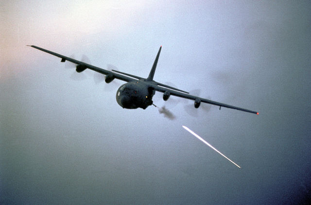
Two decades later as the Vietnam conflict became an intractable guerilla war, indiscriminate aerial "carpet" bombing resulted in high numbers of civilian casualties that demoralized friend and foe alike. This inspired the Air Force to reconsider the idea of precision bombing with the introduction of the AC-130 fixed-wing gunship, which was a highly-maneuverable, heavily-armed aircraft equipped with the latest technology for precisely raining destruction on guerilla fighters and their supply lines. However, the AC-130 was just as vulnerable to ground fire as it's ancestor aircraft, and the small number of aircraft deployed late in the conflict played only a minor role in that ill-fated war.
Project 621B
One of the engineers on the AC-130 development team was Brad Parkinson, a graduate of the Naval Academy who later earned a doctoral degree in astronautics from Stanford. Parkinson's team developed the AC-130 fire control system, and he deployed with the aircraft to Southeast Asia to operate that system on night missions.
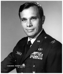
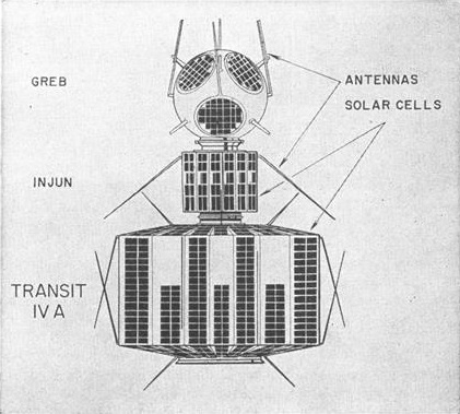
Upon his return to the states, Parkinson was asked to helm Project 621B, an Air Force program to build a satellite-based passive ranging system that began in 1963 with a focus on ICBM guidance and precision bombing. Project 621b followed closely on the heels of the TRANSIT satellite-based navigation system deployed by the US Navy in 1964 that submarines could use to find accurate location information.
One of Parkinson's primary challenges was that the Air Force leadership was actually not interested in Project 621B. While the Air Force builds and operates spacecraft, the other (competing) branches of the military are the primary beneficiaries of space services. Aircraft navigation was fairly well mastered by the early 1970s, making the idea of an expensive investment in novel satellite navigation technology indefensible. The Air Force was also run by pilots, and funding spent on space was less funding for manned aircraft operations. In August of 1973, the Air Force leadership decided to kill Project 621B.
The Joint Program Office
Following the termination of Project 621B, Parkinson and Malcolm Currie, the United States Under Secretary for Defense Research and Engineering, came up with the idea of forming a Joint Program Office that would be overseen by the Department of Defense and managed by the Air Force, but which would include representatives from other branches. The idea was that having stakeholders from the other branches would make the program more politically viable.
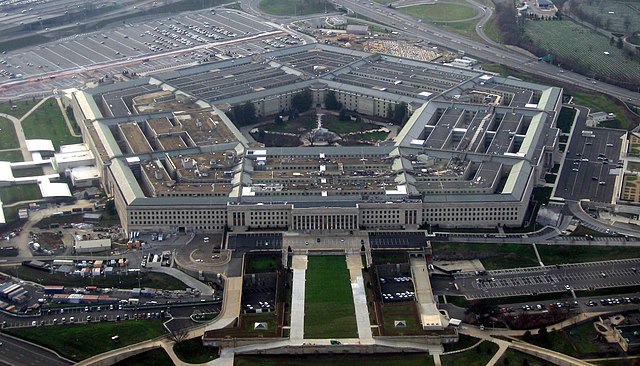
On Labor Day weekend 1973, Parkinson convened what he would later call the "lonely hall meetings" at the Pentagon to hash out a comprehensive plan for what GPS would become. Drawing on research that had been part of a decade of Project 621B work, as well as lessons learned from the existing TRANSIT, Timation, and SECOR satellite systems, the team sketched the basic outline of what was initially called the Navstar Global Positioning System. The meetings resulted in a seven-page Decision Coordinating Paper (DCP), which was the basis for subsequent presentations to various Pentagon offices. The JPO was approved on 14 December 1973 and Parkinson became its head.
Building GPS
Parkinson had a valuable "combination of gall and charm" that was required to shepherd such a complex program through the political minefield that awaited. Parkinson also had a laser-like focus on the primary mission of the program, which he noted with a sign on the wall of his program office:
The mission of this program office is to
- drop 5 bombs in the same hole,
- and build a cheap set that navigates,
- and don't you forget it.
From 1974 to 1978, Parkinson and a small army of engineers and contractors executed the plan that had been developed on that fateful Labor Day weekend of 1973.
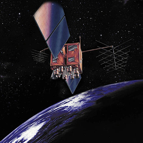
The first experimental GPS satellite (NTS-2) launched in June of 1977 from Vandenberg Air Force Base in California on a repurposed Atlas V ballistic missile. Of the three receiver contractors, engineers from Collins Radio in Cedar Rapids, IA were the first people to receive a GPS signal.
The first operational GPS satellite was launched on 22 February 1978 and testing began in Arizona to determine whether the new system would be effective for precision bombing. Against test targets, the computer-launched bombs landed within 10-15 feet of their targets, better than the anticipated 50-foot accuracy. In one test, six bombs only resulted in five craters, and later investigation revealed that two bombs had indeed been dropped in the same hole, completing the mission that Parkinson had posted on his wall.
Lost
Despite the technical successes, the precision bombing doctrine behind GPS was counter to the prevailing Air Force doctrine of time: air superiority with the complete control of the skies via overwhelming force. The receivers were bulky and expensive, and the General Accounting Office issued a report in 1977 criticizing the program's cost overruns. Parkinson declined an offer to become an aid to the Secretary of Defense and retired from the Air Force.
While the program survived renewed calls for cancellation in 1979, like the Apollo moon program of a decade before, achievement of the initial technical objective left the program without a clear strategic direction.
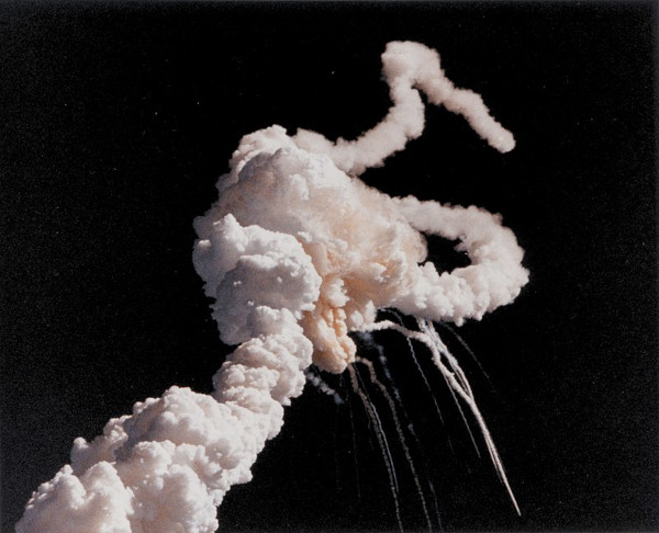
After Korean Air Lines flight 007 was shot down in 1983 by the Russians for straying into Russian airspace (without GPS guidance), President Reagan officially directed the Air Force to make GPS available for civilian use, although it would be another decade before receiver costs started to become low enough for broad consumer use. The Space Shuttle Challenger accident in 1986 put further launches on hold.
Precision Bombing Revisited
On 15 April 1986, two months after the Challenger disaster, the US carried out Operation El Dorado Canyon, a raid on military facilities and training camps in Libya, in retaliation for the bombing of a nightclub in West Berlin that killed three people and wounded more than two hundred. Although the mission was considered a success, it also killed an unknown number of civilians including one child, two American servicemen were killed, and one bomb came very close to hitting the French embassy.
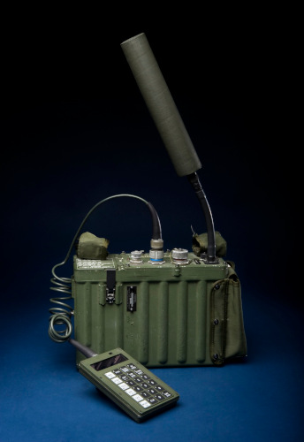
As the Air Force searched for ways to mitigate the collateral damage associated with missions like Operation El Dorado Canyon, the accuracy afforded by new GPS technology made it possible to reconsider the six-decade-old concept of precision bombing. The Air Force secretly modified a group of air-launched cruise missiles with GPS guidance, and the Strategic Air Command added them to the nuclear arsenal in 1988. A new generation of GPS satellites were launched in 1989 and were positioned for maximum worldwide coverage. The Army received its first backpack-sized portable Manpack receivers, and war games demonstrated the utility of GPS for a variety of battlefield uses.
GPS Goes to War
On 2 August 1990, the Iraqi Army invaded and occupied its southern neighbor, Kuwait. Over the next five months, the US assembled an international coalition to remove the Iraqis from Kuwait as the Air Force scrambled to get the balky new constellation of GPS satellites prepared for combat use.
The air campaign for the war was led by General Chuck Horner. Brigader General Buster Glosson was tapped to plan the campaign. Both men had both been scarred by their experiences in Vietnam and the prospect of GPS guided munitions that would be both effective and efficient without unnecessary casualties or destruction was very appealing. This would enable a strategy of taking control by air with an overwhelming show of force that would shorten the conflict.
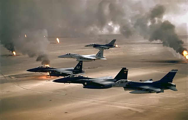
For the first shots of the war on 16 January 1991, a pair of GPS-guided Air Force Pave Low III helicopters led four Army Apache attack helicopters into the dark desert to launch Hellfire air-to-ground missiles at Iraqi radar defense sites before being guided back to base by the Pave Lows. GPS guided drones revealed the locations of additional radar sites. B-52 bombers guided by GPS flew low to destroy airfields and additional targets were located with GPS-assisted radar aboard U-2 reconnaissance aircraft.
During the ground offensive, the Iraqis assumed that Coalition forces would be lost in the vast, faceless desert, but GPS enabled the first large-scale deep desert advance in history. GPS guidance allowed allowed tanks and mechanized infantry to move quickly, cutting down on the risk of accidents and friendly fire, especially during extended periods of low visibility at the start of the ground battle. GPS was used to guide logistics, targeting, and artillery positioning. GPS was used to report on the locations of mines and, subsequently, to aid in mine removal after the battle.

Global Reach, Global Power
While the actual number of GPS devices was only probably around 7,000 in support of a half-million-person fighting force, the imperial symbolism of the new technology was obvious. Later tragic debacles in Iraq II and Afghanistan would expose the limitations of technology for conducting war, but for a time after the first Gulf War, the possibilities enabled by GPS seemed endless. As Iraq War air campaign architect Buster Glosson later stated:
It is a profound political statement for a nation-state to take off within its own boundaries and deliver a weapon as precise as [this one] was. It showed that if we wanted to expend that many resources, we could make a significant impact halfway around the world. And nobody could do anything about it. We didn't need lands, we didn't need bases, we didn't need anything.